English| EUR
Suggested for you
More currencies
Choose a language
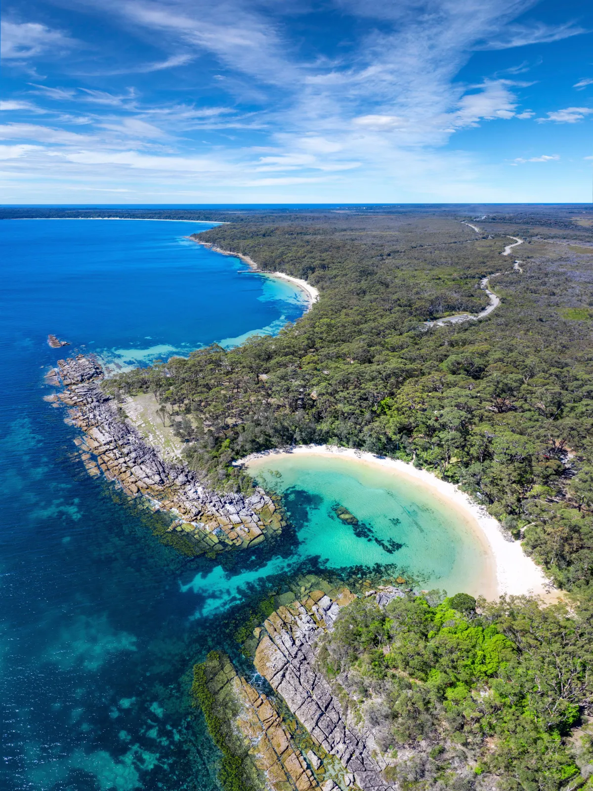
Jervis Bay sits 200 kilometers south of Sydney on the New South Wales south coast, accessible by car, coach, and train combinations. The journey takes between three and four hours depending on your chosen route and mode of transport. This guide covers every practical option for reaching the white sand beaches and national park trails that define the region.
Quick answer
The drive from Sydney to Jervis Bay takes approximately three hours via the Princes Highway (route A1/B73). Departing Sydney through the southern suburbs, you'll pass through Wollongong and Kiama before reaching Jervis Bay Road near Nowra. A vehicle pass costs 20 AUD for day entry to Booderee National Park, and arriving between 07:00 and 10:00 secures parking at popular beach locations before peak visitor numbers arrive.
More than 180,000 vehicles travel the Sydney to Jervis Bay corridor each year, yet many first-time visitors underestimate the planning required for a coastal route that threads through national park territory and small township infrastructure. The region encompasses multiple beach access points spread across 20 kilometers of coastline, and your arrival strategy changes depending on whether you're heading to Hyams Beach in the north, Booderee National Park in the south, or the township of Huskisson at the bay's western edge. The Princes Highway carries most traffic south from Sydney, splitting at Nowra where Jervis Bay Road branches east toward the coast. This final 20-kilometer stretch narrows to two lanes and services all visitor traffic during summer weekends, creating bottlenecks between 11:00 and 14:00. Travelers using rideshare or tour coaches bypass parking concerns but sacrifice flexibility once inside the park, where beach-to-beach distances require a vehicle. Public transport reaches Bomaderry station near Nowra, requiring a connecting bus service to cover the remaining distance to Huskisson, the region's accommodation and dining hub. Road conditions along the Princes Highway remain sealed and well-maintained year-round, though fog banks roll inland from the coast during winter mornings and reduce visibility between Kiama and Nowra. Mobile coverage drops intermittently south of Berry, and the final approach along Jervis Bay Road offers limited fuel or food services. Booderee National Park operates a vehicle entry system rather than per-person ticketing, making carpools cost-effective for groups. The park opens at 07:00 daily, and early arrivals claim beach parking at Murrays Beach and Green Patch before the lots fill. Traveling to Jervis Bay from Sydney rewards advance route planning, particularly for visitors unfamiliar with regional road networks and limited public transport frequencies outside peak season. The coastal townships maintain a year-round population under 2,000, and infrastructure reflects that scale rather than metropolitan convenience.
“The final 20-kilometer stretch along Jervis Bay Road services all visitor traffic and narrows to two lanes, creating predictable bottlenecks during summer weekends.”
Jervis Bay is located on the South Coast of New South Wales, approximately 200 kilometers south of Sydney. The most direct approach is by private vehicle, though public transport options are available.
M1 Princes Motorway via Wollongong
South Coast Line from Sydney Central to Bomaderry Station
Connecting bus service from Bomaderry Station to Huskisson
For those driving, Jervis Bay Road serves as the primary access point. Refer to the best arrival window to ensure you secure parking at your chosen beach location.
Booderee National Park operates daily throughout the week. The park maintains consistent hours for visitors arriving from Sydney.
A few practical steps will set you up for a smooth trip to Jervis Bay.
Everything you need to know about how to get to jervis bay from sydney
Travelers typically reach the region by private vehicle or rental car, which allows for the most flexibility when exploring the coastline. Many visitors use the M1 Princes Motorway for a direct route southward from the city.
The drive generally takes approximately three hours depending on traffic conditions and your specific departure point within the metropolitan area. It is recommended to plan for extra travel time during weekends and holiday periods.
Public transport options are limited and often require a combination of train and bus services to reach the coastal villages. For many travelers, driving remains the most practical method when evaluating how to get to jervis bay from sydney for a day trip.
Visitors entering Booderee National Park must pay an entrance fee of 20 AUD, which covers a one-day vehicle pass. This fee is standard for all vehicles entering the protected area.
The best arrival window is between 07:00 and 10:00 to avoid peak visitor crowds and secure parking at popular beach locations. Arriving early ensures you can enjoy the white sand beaches before the midday rush.
Various third-party transport operators offer guided day excursions for those who prefer not to drive themselves. These services can be a convenient alternative when planning how to get to jervis bay from sydney.
Always verify road conditions and seasonal weather before your departure to ensure a safe journey. Having a reliable navigation map is essential for navigating the coastal routes effectively.